

AN RTÉ Prime Time report has detailed a number of issues which were flagged long before the fatal Rescue 116 crash occurred last March.
Four Irish Coast Guard aircrew – Captain Dara Fitzpatrick, Captain Mark Duffy, Winchman Ciaran Smith, and Operator Paul Ormsby, all lost their lives when their helicopter collided with Blackrock island on March 14th of this year. The bodies of both Smith and Ormsby are yet to be recovered.
The Air Accident Investigation Unit denied any mechanical fault in its preliminary report and is still leading the investigating agency. The Health and Safety Authority is responsible for implementing enforcement action in relation to crew workplace safety and are now working with An Garda Siochana on a joint investigation that will result in a file eventually being delivered to the Director of Public Prosecutions.
The report, carried out by journalist Katie Hannon, revealed that concerns were raised about pilot life jackets, navigation equipment, aeronautical maps and unclear safety regulation responsibility as far back as 2012.
With regard to the life jackets, there had been repeated warnings that life jackets worn by the crew were not fit for purpose, with the reason being cited as the personal locator not operating correctly due to it’s proximity to the GPS antenna which was located in the same pouch. According to the reports featured on Prime Time, the personal locator had “absolutely zero receivable transmissions” as a result.
When Capt Fitzpatrick was found in Blacksod Bay, she had been in the water for almost 90 minutes, was pronounced dead later in hospital. Her life jacket was fully inflated, and her colleagues believe that if her beacon had been working she could have been located much sooner.
In terms of navigation, the programme revealed flaws in the data available to the crew on the night of the crash. Supposedly, Black Rock island on the coast of North Mayo was displayed as a dot with a mostly flat surface, despite the island having the highest point of 282 feet.
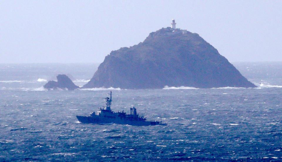 Black Rock Island, Belmullet, Co. Mayo. (Picture: RTE)
The report revealed that a flight safety meeting attended by Ormsby in Septemeber 2016, highlighted issues with the moving map system on board and declared that it should not be used for primary navigation. This prompted calls for improvements to be made immediately by crew members, which were never acted on.
