


A SERIES of new geophysical maps released this week unveil the hidden beauty of Co. Donegal.
Three images have been released by the Geological Survey Ireland (GSI) organisation in their ongoing Tellus county maps project.
Showcasing the county from an entirely new perspective, the colourful maps show the magnetic, electromagnetic, and radiometric properties of the land itself.
 Three new geological images of county Donegal have been released this week
Since 2011, the Tellus programme of GSI - which is a division of Ireland's Department of the Environment, Climate, and Communications - has been collecting geophysical data via onboard instruments on low-flying aircraft.
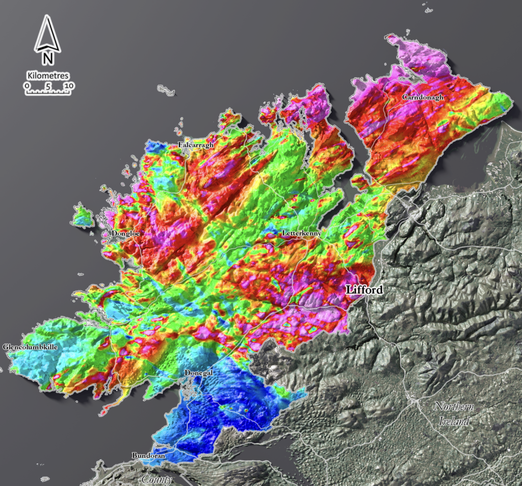
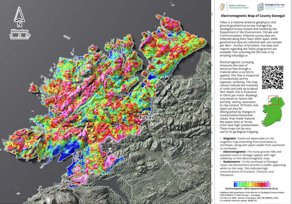 The electromagentic map of Donegal
They have then compiled the data into a series of county maps with explanations on the information shown and key facts on the findings, with Donegal their latest county completed.
"Geologists and geophysicists have a different way of looking at things, both in terms of time and space,” Koen Verbruggen, the Director of Geological Survey Ireland, said.
“They use colour to represent different properties of rock or millions of years in time."
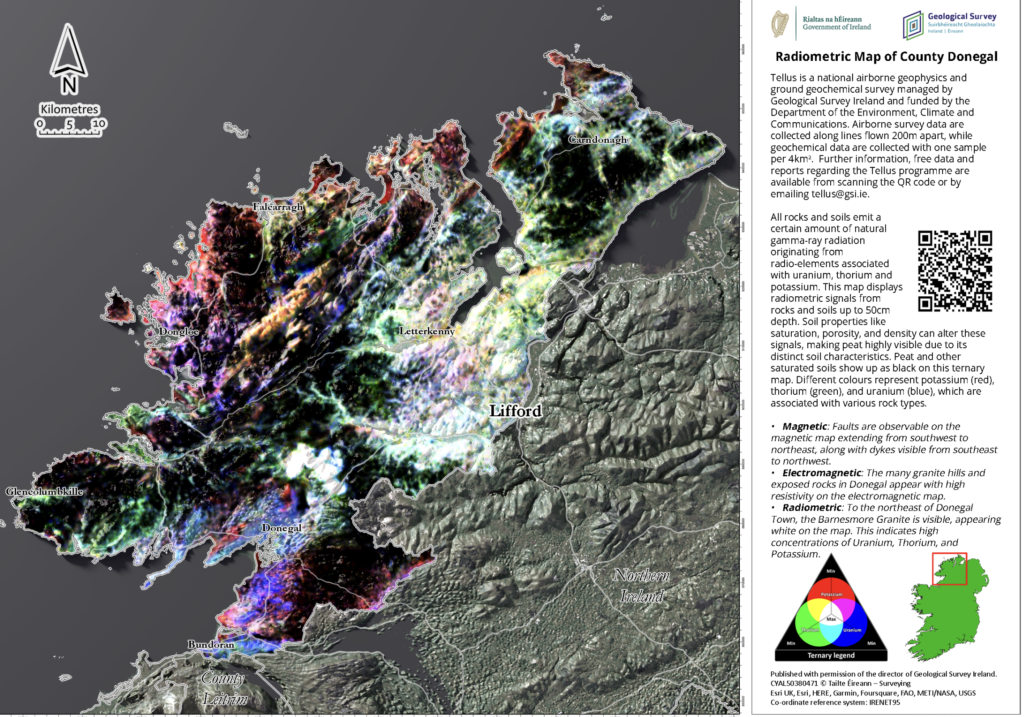 The radiometric map of Donegal
He added: "People may remember the aircraft flying low above their homes and might have wondered was there anything unusual found in their county.
“These maps are a chance to show the results in a form that’s accessible to all and to show people a different way to look at County Donegal."
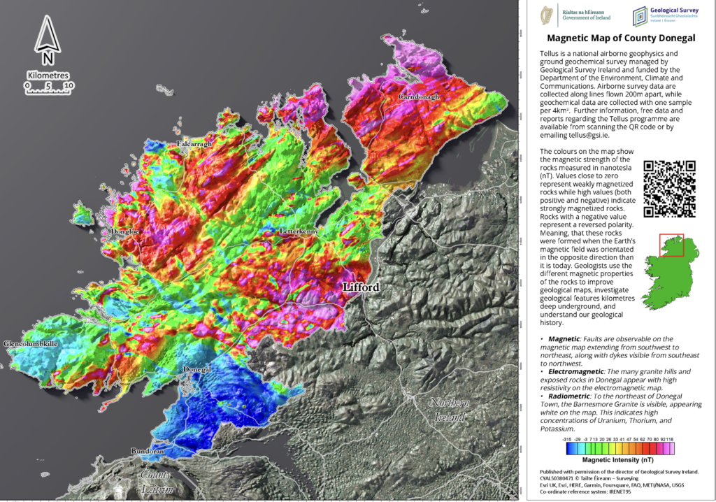 The magnetic map of Donegal
Donegal’s granite mountains and hills appear with high resistivity in the electromagnetic map, according to Geological Survey Ireland, while the magnetics map reveals faults running southwest to northeast, along with dykes running southeast to northwest.
The radiometrics map highlights the Barnesmore granite to the east of Letterkenny, which appears white on the map.
“Airborne geophysics is a cost-effective means of detecting the physical properties of soil, rock, and water beneath the ground,” the organisaion said.
“The data can be used for various purposes, for example, geological mapping, mineral exploration, radon risk mapping, and geothermal energy exploration through the understanding of the subsurface.”
The Tellus programme first started in Northern Ireland.
All of its surveys of the island of Ireland are due to be completed by 2026.
See More: Donegal
